
Battle Creek Postal Areas and ZIPs
The City’s 2019 relocation booklet identifies six ZIP codes serving Greater Battle Creek: 49014, 49015, 49016, 49017, 49018, and 49037. The booklet supplies a Greater Battle Creek list, not a set of exact legal polygons or neighborhood boundaries. Postal service areas can extend beyond a municipality, change by delivery decision, or have a post-office role that does not describe a residential area. For a particular mailing line, confirm it through USPS and then check the parcel jurisdiction separately.
| ZIP | Areas Covered | Post Office | Notes |
|---|---|---|---|
| 49014 | Greater Battle Creek; city appendix includes ZIP-specific context | Battle Creek-area postal routing | Listed by the city as a Greater Battle Creek ZIP |
| 49015 | Greater Battle Creek | Battle Creek-area postal routing | Postal last-line deliveries moved to 49037 in a 2007 bulletin |
| 49016 | Greater Battle Creek and post-office context | Battle Creek Post Office, 90 McCamly Street South, Battle Creek, MI 49016-9000 | Do not equate the post-office ZIP with a residential boundary |
| 49017 | Greater Battle Creek; city appendix includes ZIP-specific context | Battle Creek-area postal routing | Verify a particular address in the USPS tool |
| 49018 | Greater Battle Creek | Specific station details were not located in the reviewed official capture | Use a live USPS result for the address |
| 49037 | Greater Battle Creek | Battle Creek-area postal routing | 2007 delivery-line change may include addresses beyond city limits |
Neither the city booklet nor the table assigns every street to a neighborhood. The ZIP code directory is therefore a postal starting point, not a substitute for a current USPS address result or a parcel map.
Source dates matter even in a short coverage list. The relocation booklet reports about 42.61 square miles of city land area, while Census QuickFacts reports 42.59 square miles for its own source version. Those figures describe differing source versions, not a boundary adjustment that should be blended into a single map claim. Keep the source and date next to any geographic figure used with a Battle Creek ZIP code.
Note: Treat the six-item Greater Battle Creek ZIP list as a source-dated postal reference, not as a detailed neighborhood map.
USPS Routes for Battle Creek Addresses
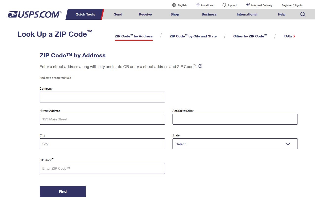
The official USPS ZIP Code Lookup offers three useful modes. “By address” is the best way to normalize a full mailing address. “By city and state” lists postal options for a city name, and “Cities by ZIP” checks the city names associated with a code. Each result concerns delivery routing. It does not identify a mail recipient, establish ownership, or prove who occupies a parcel.
| Lookup mode | Required inputs | Optional inputs | Use |
|---|---|---|---|
| By address | Street address, city, and state | Company, apartment or suite, ZIP | Check the postal form of a specific address |
| By city and state | City and state | None listed | See postal ZIP options connected with that city and state |
| Cities by ZIP | ZIP | None listed | Check city names connected with the entered postal code |
The USPS lookup screen shows the address, city/state, and cities-by-ZIP routes used to verify Battle Creek ZIP code information.
For the 49016 post-office context, the official Battle Creek Post Office listing gives retail hours of Monday through Friday 9 to 6:30 and Saturday 9 to 3, with PO Box access 7 to 7 daily. Check the listing again before traveling.
Battle Creek Parcel ZIP Fields
Battle Creek’s parcel layer includes propzip, ownerzip, and taxpayzip fields. They describe different parts of a property record: the property address ZIP, the owner ZIP, and the tax-payer ZIP may not match. The city data layer can be filtered by ZIP, while the assessor and BS&A route supports address-based property research. The reviewed basic public interface did not expose a ZIP-only search that returns a resident or parcel list.
That gap is important. A property owner field is not occupancy evidence, and a postal code cannot establish a person’s connection to a parcel. Use the city parcel layer with a known address or parcel PIN, retain the source date, and ask the custodian about access when the public interface lacks the needed filter.
For a precise location question, the sequence is postal form, parcel identifier, and map jurisdiction. The assessor record can identify listed owner, tax-mailing address, and parcel fields, while the GIS layer supplies mapped geometry and public layers. Each source answers a narrower question than a ZIP code alone. Keep the owner and taxpayer fields distinct, and do not turn either one into a claim about mail delivery or day-to-day presence.
Battle Creek Postal Delivery Changes
Postal history can make a correctly copied old address look wrong in a newer system. The 2007 USPS Postal Bulletin says that 5,189 Battle Creek deliveries using 49015 received 49037 as their last line. The change was a postal-delivery decision, not proof that every affected property left the city or changed parcel jurisdiction. A later address trail should preserve both the historical line and the source date.
- 2007: the bulletin records the 49015-to-49037 last-line change for 5,189 deliveries.
- 2018: a USPS bulletin documents further ZIP-label changes involving 49012, 49014, 49015, and 49016.
When a historical directory or deed uses a ZIP, record it exactly, consult the period postal notice if available, then compare a current USPS result with city and county map layers.
Search Battle Creek Records by ZIP
A ZIP code can narrow a map or dataset, but it is not an all-purpose name search. The reliable path begins with a full address and separates the postal result from the parcel record. Where an address is unknown, the USPS city-and-state mode can reveal postal options, but it cannot supply a list of people at those addresses. The city’s ZIP-related parcel fields are useful only when their field meaning is kept clear.
- Run the exact street address through USPS and save the returned postal form with the lookup date.
- Search the Battle Creek BS&A property search or city parcel source by the normalized address, then record the parcel PIN and the ZIP field being used.
- Where a data-layer filter is available, distinguish propzip from ownerzip and taxpayzip rather than treating them as the same address.
- Check city or county GIS for the parcel’s municipal, ward, precinct, school, and county context before choosing a local office.
- Once a street is known, use the Battle Creek street directory for the separate street-level record path.
Use a ZIP filter as a location tool, then verify the single record that answers the actual question. No official ZIP-only public resident or parcel interface was located in the reviewed material.
Note: A ZIP-filtered field is only useful when its meaning is documented, especially where property, owner, and taxpayer ZIPs differ.
Battle Creek Postal and City Lines
ZIP boundaries do not answer the same question as Battle Creek city limits. A postal area can cross municipal lines or retain a mailing label while an address belongs to a different public jurisdiction. Local research may move among Battle Creek, Springfield, Pennfield, wards, precincts, school districts, ZIPs, and county jurisdiction. Use the mailing result to start, then locate the parcel and identify the relevant city, township, ward, and precinct records.
The Michigan DTMB ZIP Code map warns that its ZIP boundaries are approximate. It is helpful for context, but a parcel PIN and city or county GIS are more precise for a boundary question.
- ZIP and ZIP+4
- A ZIP identifies a postal delivery area. ZIP+4 adds a more specific delivery segment, not a legal property boundary.
- PO Box ZIP
- A ZIP used in a post-office box context. It should not be assumed to describe a residential service area.
- Unique ZIP
- A ZIP assigned for a single organization or special delivery purpose. No such status is assumed for any Battle Creek ZIP here.
- Carrier route
- A postal delivery sequence used for mail handling. It is not a municipal, voting, or parcel boundary.
Battle Creek ZIPs and Civic Maps
Postal geography and civic geography often overlap, yet neither replaces the other. The city’s address-to-ward and precinct route is a practical second check after USPS normalization, especially when a postal label extends beyond a city-limit line. It can identify the public voting geography tied to an address without treating a ZIP as a ward or precinct.
The Battle Creek Wards and Precinct Maps route an address toward its ward, precinct, and polling-location information.
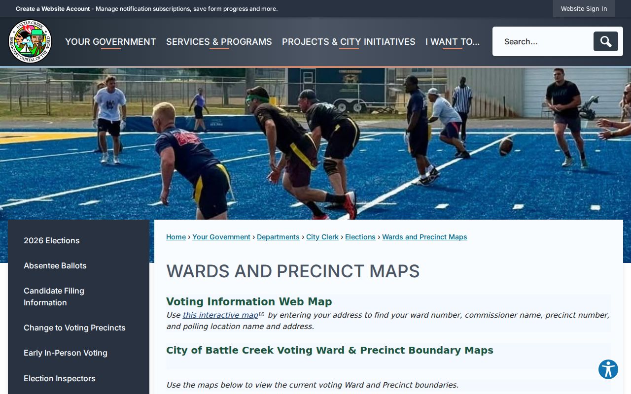
Follow the map result with the city or county GIS when the question is a parcel line, township boundary, or local-service jurisdiction.
ZIP-Level Context in Battle Creek
The city’s 2024 to 2025 real-estate-market appendix includes a 2023 table with ZIP-tabulated demographic context for 49014, 49015, 49017, and 49037. Those figures are geographic estimates, not characteristics of any individual, household, or address. They can provide broad context for a ZIP code directory, but they should never be used to infer who receives mail at a particular property.
The city appendix labels the table’s date and geography. Keep both labels when citing any ZIP-level statistic.
Date a Battle Creek Postal Result
Every ZIP claim needs a date because a current USPS result, a 2019 city booklet, a 2007 postal bulletin, and a 2023 ZIP estimate describe different moments and different kinds of geography. A sound note records the address as printed, historical ZIP if present, current USPS result, postal bulletin date where relevant, parcel PIN, and city or county jurisdiction. That simple record prevents a historic mailing line from being mistaken for a present boundary.
Note: Preserve the postal source date beside any Battle Creek ZIP code result so a later boundary or delivery change remains visible to the next researcher.