
Search Battle Creek Streets by Address
A Battle Creek street search works best as a chain of property records, not as a roster of people. Use the exact address after checking its USPS form, then keep the street spelling, ZIP, parcel PIN, and source date together. City property data can identify a listed owner and the parcel. A map can place that parcel among roads, schools, and public facilities. A deed can connect one recorded transfer to the prior one. Historic directories can put a household at an address in a stated year. Those are different claims and should remain separate.
- Enter the normalized address in Battle Creek BS&A and record the matching parcel PIN, property address, and listed owner or mailing field.
- Compare that parcel in the city or county GIS viewer. Confirm the polygon and street location before treating two similar addresses as the same property.
- Use the city’s address-based ward and precinct route only for its civic location context. The Michigan Voter Information Center is an individual status and polling-place service, not a street-by-street download.
- Search the recorded owner as a grantee in the Calhoun index, then read the legal description and prior grantor to begin a deed trail.
- For a dated household clue, use a reverse or criss-cross directory and compare its year with maps and the recorded chain.
When an address falls near a municipal boundary, compare city limits and parcel jurisdiction before choosing a city or county route. The county-seat split matters too: the land-record custodian is in Marshall, while the assessor and many map resources are in Battle Creek.
Battle Creek Street Directory Parcel Search
The public BS&A search is the practical first stop for an address that is inside the city. It separates Assessing, Building Department, Current Tax, Delinquent Personal Property, and All Records routes. An account is not required for the public search, although it may be used for saved features. The city assessor says its records cover ownership, property characteristics, sales, addresses, principal-residence exemption status, and assessment information. Those entries describe the parcel and tax administration, so a listed owner or tax-mail recipient is not automatically the person living there.
| BS&A field or control | Use in a street search | Research note |
|---|---|---|
| Name | Find a parcel tied to a listed owner or taxpayer name. | Compare with the address and PIN. |
| Address | Start with the physical street address. | Includes street-address and number-range controls. |
| Advanced Address Search | Refine a difficult street or numbering search. | Use the route shown in the public interface. |
| Parcel Number | Return to the same parcel after an address changes format. | The PIN is the stronger cross-record key. |
| Building Department Record Number | Locate a known building-department record. | Available among the public search choices. |
If the municipal entry is incomplete, the county property search also accepts owner name, location, property number, and tax-bill routes. Its location search can be more effective with the street name alone, but it does not use all years. The assessor provides cards, sketches, photographs, and corrections through its own channel; ask for the particular existing record and verify the current copy terms rather than assuming a portal view is the full file.
Map a Battle Creek Street Result
City GIS supplies the spatial check that a text search lacks. The parcel layer includes the PIN, listed-owner fields, property-address components, tax-mailing fields, zoning, property classification, school district, and record or image links. Its companion city GIS page groups maps for parcels, roads, voting, construction projects, civic facilities, parks, and schools. Use those layers to understand where an address sits and which public boundary applies. Do not convert the layer into a proximity list or treat a mailing field as occupancy evidence.
The City of Battle Creek parcel layer shows the structured fields behind a parcel search.
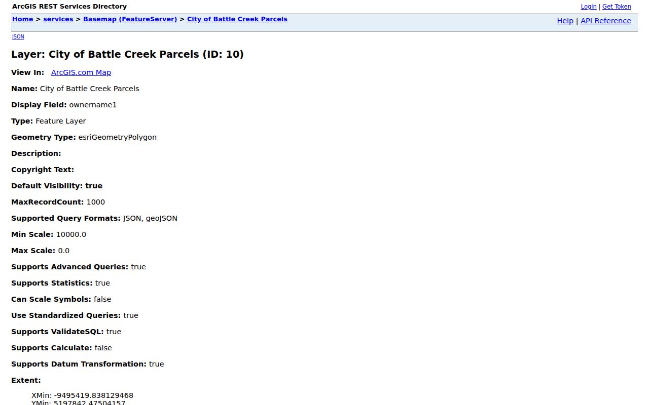
Read the image as a parcel-record route: the layer helps connect an address, PIN, map geometry, zoning, and school-district context, while the recorded document and dated directory provide separate evidence.
Calhoun County GIS offers another public parcel and thematic-map route, including school-district and flood-hazard tools. Where the map and property card disagree, preserve both source dates and ask the relevant custodian for the record that controls the question.
Battle Creek Street Records by Address
Several record systems are keyed to an address, but each answers a narrower question. A parcel card and tax account can tie an address to a PIN and administrative owner fields. A recorded instrument can establish a document trail. Maps show geography. Building and code records may document a public project, inspection, or status. A historic publication can place an individual or firm at the printed address for its publication year. The following matrix keeps those functions apart.
| Address record | Battle Creek or Calhoun keeper | What it can show | Access route |
|---|---|---|---|
| Assessor card | Battle Creek Assessor | Listed owner, tax mailing, characteristics, sales, assessment, PRE. | BS&A or assessor request. |
| Tax account | Calhoun tax administration | Property number, tax bill, roll or payment context. | County property or tax search. |
| Parcel map | City or county GIS | PIN, polygon, zoning, school district, map context. | Public viewer and city REST layer. |
| Recorded instrument | Clerk and Register of Deeds | Grantor, grantee, date, type, subdivision, document number. | Official records index or recorder. |
| Building or code record | City inspection or Code Compliance | Public construction, inspection, land-use, or status evidence where available. | BSA route, city office, BC311, or a narrow FOIA request. |
The parcel PIN and legal description make the strongest bridge between the property card and recorded instruments. A street name alone can vary in punctuation, direction, numbering, or historic form. For a city record not online, use the city’s NextRequest portal for a specific existing record, date range, and address. Michigan FOIA does not require staff to create a new analysis of everyone associated with a street.
Calhoun Deeds Behind Battle Creek Streets
The Calhoun Official Records Search is the official index for the grantor, grantee, subdivision, document-type, document-number, and recorded-date routes. Start with a precise party or legal-description term, then narrow the recorded-date range. The interface offers index-only searching and index plus full-text OCR. In index-only mode, two or more words are searched individually; OCR is better reserved for a phrase in scanned text and can misread it.
The portal displays a certification statement through 05/11/2023. That statement is not a historical start date, a complete end date, or proof that later records are unavailable. Check current coverage in the portal and ask the Clerk and Register of Deeds for document, image, or certification details when the index does not settle the question. The county office is in Marshall at 315 W Green Street, so a Battle Creek address researcher may need both the city property route and the county recorder route.
For older land research, the Archives of Michigan Calhoun guide identifies land, mortgage, assessment, plat, and court series. FamilySearch catalogs early Calhoun deeds from 1833 to 1843 on microfilm or DGS. Those historical sources complement an official recorded-instrument search; they do not replace a current certified record.
Voting Context for Battle Creek Streets
An address may also have a ward, commissioner, precinct, and polling-place context. The city’s wards and precincts route is the official address-based source for that context. It is useful when a historic newspaper, civic notice, or directory mentions a precinct. Precincts have changed: the city documents consolidations affecting prior Ward 1 and Ward 2 precincts. An old precinct label may therefore need to be translated before it is compared with a current map.
For an individual voter, MVIC requires first name, last name, birth month, birth year, and ZIP for its name route, and provides registration-status, polling-place, sample-ballot, absentee, and clerk links. It is not a tool for building a street list. Michigan withholds driver-license or state-ID number, month and day of birth, phone, email, and internal fields from the public voter-record context. A substitute address used through the Address Confidentiality Program is confidential and should never be treated as evidence of a move or error.
Battle Creek Street Names Through Time
A modern map can hide the reason an old address fails to match. The National Register material for the Battle Creek Downtown Historic District refers to 1871–72 and 1886 directories and notes street-renumbering changes. The city’s street-renaming ordinance also requires review by offices that include the assessor, GIS, Code Compliance, Building Inspection, the Historical Society, utilities, telecommunications, and USPS. That cross-office process explains why a new name or number can ripple through tax cards, deeds, maps, voting references, permits, and local books.
Search the former and current street names, then compare the block with Sanborn editions from 1887, 1892, 1899, 1902, 1907, and 1913. The Library of Congress and Willard materials can supply dated street and building context. Battle Creek’s heritage-street list, which includes names such as Division, Main, Michigan, North Avenue, and Washington, is another signal to slow down and preserve the address as printed in the source.
Battle Creek Maps for Streets
Street research becomes more reliable when the map layer is matched to the question. Parcel geometry helps identify a property. Roads and construction layers add public project context. Voting layers help interpret ward and precinct references. Civic facilities, parks, schools, and county thematic maps can explain the setting without assigning names to neighboring parcels. The city GIS catalog is the clearest starting point for choosing a layer rather than assuming every detail belongs on the parcel card.
The Battle Creek GIS page groups the city’s parcel, road, voting, and construction map categories.

Use the shown categories as a map-selection step, then keep the map date with the record date. A parcel boundary, a postal line, a school district, and a ward are different kinds of geography.
Battle Creek Address Record Terms
Property language can make a street record seem more certain than it is. These terms help keep the address trail readable when a parcel card, map, deed, and reverse directory use different labels for the same place.
- Parcel or PIN
- A parcel is a defined piece of land; the PIN is its identifying number in the property record. It is often more stable than street formatting.
- Situs address
- The physical location of the parcel. It differs from a tax-mailing address, which is where correspondence is sent.
- Plat
- A recorded map or subdivision layout that helps locate lots and blocks when the street number has changed.
- Criss-cross directory
- A reverse directory organized from address to printed name for selected years, useful for historical rather than current occupancy clues.
Willard holds local-history records, maps, and directories. Its digitized directories have a remote portion for library-card users from 1890 through 1927, with fuller access on library computers and a librarian-search request for people who cannot travel. The historical volumes are a dated evidence layer, not a substitute for a present-day property record.
Limits of a Battle Creek Street Directory
A listed owner, taxpayer, or mailing recipient does not prove occupancy. A historic directory has its own publication date and can be self-reported. An absent name does not establish that someone was never present. Driver-record personal information is protected under the federal Driver’s Privacy Protection Act and Michigan law. The Michigan Address Confidentiality Program can place a substitute address in public-facing government transactions for eligible participants, so public fields must not be used to infer an actual residence.
Use an address trail for property history, family history, civic context, or a narrowly defined public-record question. Do not combine property, voter, directory, and map fields into a current-person file or a list of people near an address. For safety concerns, contact law enforcement or victim-support services rather than trying to locate someone through records.
Lawful use. Battle Creek street records support careful, personal research. Michigan stalking law, MCL 750.411h, makes repeated unwanted contact and approaching a residence legally significant; do not use address information to stalk, harass, intimidate, or harm anyone.